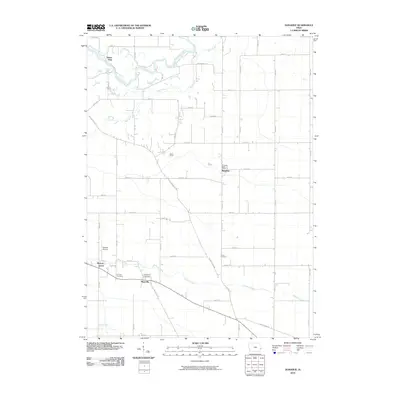
2010 Map of Donahue
USGS Topo · Published 2010About this map
The Wapsipinicon River meanders across the northern edge of this Scott County landscape, defining the northern limit of the agricultural townships near Donahue. The settlement of Donahue serves as a local hub, anchored by the Donahue Post Office along the grid of county roads. To the south, Maysville sits at a crossroads near the winding Hickory Creek, which cuts through the fertile farmland. This area is punctuated by historical local burial grounds, including Burch Cemetery, Maysville Cemetery, and O'Toole Cemetery, which offer valuable locations for genealogical research. The presence of Stender Airport near Hickory Grove indicates the continued utility of the open terrain for local aviation. The map's road network, featuring names like Allens Grove Rd and Slopertown Rd, reveals the primary transport corridors connecting established communities like Allens Grove and Buena Vista in the early 21st century.
Find a feature on this map
50 named features on this map. Tap any name to fly to it.
Don’t see what you’re looking for? This feature index may not catch every label — zoom into the map to look around manually.
Map Details
Editions of this 2010 Donahue Map
This is the sole edition of this map. No revisions or reprints were ever made.
Other maps of this area

1890 · Durant
USGS Topo · 1:62,500

1891 · DeWitt
USGS Topo · 1:62,500

1891 · Davenport
USGS Topo · 1:62,500

1892 · Wheatland
USGS Topo · 1:62,500

1894 · Wheatland
USGS Topo · 1:62,500

1894 · Durant
USGS Topo · 1:62,500

1894 · Davenport
USGS Topo · 1:62,500

1901 · Rock Island
USGS Topo · 1:125,000

1910 · Rock Island
USGS Topo · 1:125,000
1949 · Davenport
USGS Topo · 1:24,000