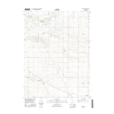
2015 Map of Donahue
USGS Topo · Published 2015About this map
The Wapsipinicon River defines the northern boundary of this landscape, separating Clinton and Scott counties in eastern Iowa. This 2015 record shows a rural agricultural pattern punctuated by several small communities, including Maysville and Donahue. The township grids are dense with family and community history, evidenced by a cluster of local burial grounds such as Linn Grove Cem, Allens Grove Cem, and Maysville Cem. Transport and infrastructure are centered around a network of county roads like Co Rd Y52 and specialized landmarks like Stender Airport. In the southeast, the growing edge of Eldridge appears, while the rest of the map is shaped by the drainage of Mud Cr and Hickory Cr, which carve subtle topography through the surrounding farmland.
Find a feature on this map
46 named features on this map. Tap any name to fly to it.
Don’t see what you’re looking for? This feature index may not catch every label — zoom into the map to look around manually.
Map Details
Editions of this 2015 Donahue Map
This is the sole edition of this map. No revisions or reprints were ever made.
Other maps of this area

1890 · Durant
USGS Topo · 1:62,500

1891 · DeWitt
USGS Topo · 1:62,500

1891 · Davenport
USGS Topo · 1:62,500

1892 · Wheatland
USGS Topo · 1:62,500

1894 · Wheatland
USGS Topo · 1:62,500

1894 · Durant
USGS Topo · 1:62,500

1894 · Davenport
USGS Topo · 1:62,500

1901 · Rock Island
USGS Topo · 1:125,000

1910 · Rock Island
USGS Topo · 1:125,000
1949 · Davenport
USGS Topo · 1:24,000