
1964 Map of Donaldson
USGS Topo · Published 1965About this map
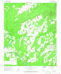
The Ouachita River meanders through the heart of this landscape, its path defined by features like Morrison Island and several feeding tributaries including Saline Bayou and Cox Bayou. This mid-century survey documents a region defined by small settlements and rural infrastructure, centered on Donaldson and the smaller community of Friendship. The Missouri Pacific railroad cuts diagonally across the terrain, serving as a primary transportation corridor between the river valley and the wooded uplands. Local life is anchored by a dense network of country churches and schools, such as the Ouachita High Sch and Mt Moriah Ch. To the south, the county lines for Hot Spring and Clark counties meet near Witherspoon, marking a transition from the river bottomlands into the timbered stretches of Brown Springs and Manchester.
Find a feature on this map
40 named features on this map. Tap any name to fly to it.
Don’t see what you’re looking for? This feature index may not catch every label — zoom into the map to look around manually.
Map Details
Editions of this 1964 Donaldson Map
3 editions found
Other maps of this area

1948 · Malvern
USGS Topo · 1:62,500

1949 · Malvern
USGS Topo · 1:62,500

1955 · Little Rock
USGS Topo · 1:250,000

1956 · Little Rock
USGS Topo · 1:250,000

1959 · Caddo Valley
USGS Topo · 1:24,000

1959 · Arkadelphia
USGS Topo · 1:24,000

1960 · Little Rock
USGS Topo · 1:250,000

1964 · Little Rock
USGS Topo · 1:250,000

1965 · Round Hill
USGS Topo · 1:24,000
1965 · Dalark
USGS Topo · 1:24,000