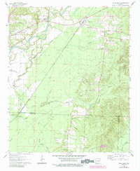
1964 Map of Donaldson
USGS Topo · Published 1984About this map
The Quachita River defines the western landscape of this central Arkansas region, carving a path past Morrison Island and the rural community of Friendship. This 1964 survey, with updates from the early 1980s, captures a network of small family and community centers like Donaldson, which sits along the Missouri Pacific railroad line. The map is particularly rich for local historians, recording the location of essential social hubs such as Quachita High Sch and several country churches including Riverside Ch and Anchor Ch.
Find a feature on this map
32 named features on this map. Tap any name to fly to it.
Don’t see what you’re looking for? This feature index may not catch every label — zoom into the map to look around manually.
Map Details
Editions of this 1964 Donaldson Map
3 editions found
Other maps of this area

1948 · Malvern
USGS Topo · 1:62,500

1949 · Malvern
USGS Topo · 1:62,500

1955 · Little Rock
USGS Topo · 1:250,000

1956 · Little Rock
USGS Topo · 1:250,000

1959 · Caddo Valley
USGS Topo · 1:24,000

1959 · Arkadelphia
USGS Topo · 1:24,000

1960 · Little Rock
USGS Topo · 1:250,000

1964 · Little Rock
USGS Topo · 1:250,000

1964 · Donaldson
USGS Topo · 1:24,000

1965 · Round Hill
USGS Topo · 1:24,000