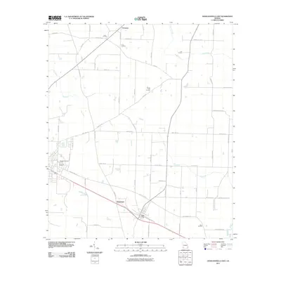
2011 Map of Donalsonville East
USGS Topo · Published 2011About this map
Iron City anchor this agricultural landscape in the southwestern corner of Georgia, where a network of rural roads connects several small settlements and family burial grounds. The terrain is defined by the winding paths of Dry Creek and Aycocks Creek, which drain the low-lying farmland surrounding Enterprise and the locality of Sharphagen. Numerous cemeteries such as Union Cemetery, Pleasant Hill Cemetery, and Lane Cemetery are scattered across the quadrangle, suggesting long-standing family ties to the land. Transport in the region is dominated by historical corridors like Three Notch Road and Ash Crossing Road, which parallel the rail line passing through the heart of Iron City. This survey provides a clear view of the rural infrastructure of Seminole County, documenting the proximity of Friendship Cemetery to the eastern outskirts of the neighboring county seat.
Find a feature on this map
55 named features on this map. Tap any name to fly to it.
Don’t see what you’re looking for? This feature index may not catch every label — zoom into the map to look around manually.
Map Details
Editions of this 2011 Donalsonville East Map
This is the sole edition of this map. No revisions or reprints were ever made.
Other maps of this area

1953 · Dothan
USGS Topo · 1:250,000

1954 · Dothan
USGS Topo · 1:250,000

1954 · Steam Mill
USGS Topo · 1:24,000

1954 · Desser
USGS Topo · 1:24,000

1954 · Tallahassee
USGS Topo · 1:250,000

1955 · Dothan
USGS Topo · 1:250,000

1955 · Bainbridge
USGS Topo · 1:62,500

1959 · Tallahassee
USGS Topo · 1:250,000

1960 · Tallahassee
USGS Topo · 1:250,000

1974 · Boykin
USGS Topo · 1:24,000