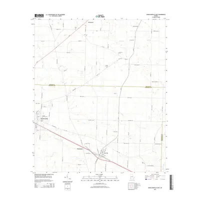
2014 Map of Donalsonville East
USGS Topo · Published 2014About this map
Donalsonville and Iron City anchor this Southwest Georgia landscape, where a dense network of local roads connects scattered agricultural settlements. The terrain is defined by the drainage patterns of Aycocks Cr and Dry Cr, flowing toward the eastern boundary near Spring Creek. This 2014 survey reveals a high density of rural burial grounds, including Pleasant Hill Cem, New Home Cem, and the Friendship Memorial Gardens, which offer significant value for genealogists tracing local families in Seminole Co.
Find a feature on this map
85 named features on this map. Tap any name to fly to it.
Don’t see what you’re looking for? This feature index may not catch every label — zoom into the map to look around manually.
Map Details
Editions of this 2014 Donalsonville East Map
This is the sole edition of this map. No revisions or reprints were ever made.
Other maps of this area

1953 · Dothan
USGS Topo · 1:250,000

1954 · Dothan
USGS Topo · 1:250,000

1954 · Steam Mill
USGS Topo · 1:24,000

1954 · Desser
USGS Topo · 1:24,000

1954 · Tallahassee
USGS Topo · 1:250,000

1955 · Dothan
USGS Topo · 1:250,000

1955 · Bainbridge
USGS Topo · 1:62,500

1959 · Tallahassee
USGS Topo · 1:250,000

1960 · Tallahassee
USGS Topo · 1:250,000

1974 · Boykin
USGS Topo · 1:24,000