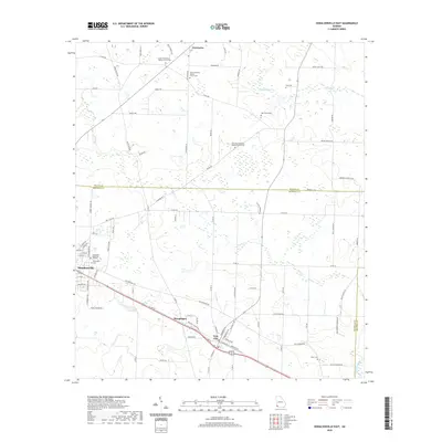
2020 Map of Donalsonville East
USGS Topo · Published 2020About this map
Donalsonville and Iron City anchor the southern portion of this landscape, connected by a corridor that includes the settlement of Sharphagen. The terrain is characterized by a high concentration of small, localized cemeteries and rural churches, reflecting the deep-rooted community history of the Georgia-Alabama borderlands. Places such as Enterprise and the Union Missionary Baptist Church Cem serve as focal points for local family history research. To the north, the landscape is defined by the headwaters of Aycocks Cr and Dry Cr, where the road network transitions from the organized streets of the town centers to winding rural routes like Smith Rd and Hornsby Rd. This map captures the agricultural and residential patterns of Seminole and Miller Counties as they appeared in the modern era, preserving the locations of numerous family burial grounds like Lane Cem and Miller Cem.
Find a feature on this map
81 named features on this map. Tap any name to fly to it.
Don’t see what you’re looking for? This feature index may not catch every label — zoom into the map to look around manually.
Map Details
Editions of this 2020 Donalsonville East Map
This is the sole edition of this map. No revisions or reprints were ever made.
Other maps of this area

1953 · Dothan
USGS Topo · 1:250,000

1954 · Dothan
USGS Topo · 1:250,000

1954 · Steam Mill
USGS Topo · 1:24,000

1954 · Desser
USGS Topo · 1:24,000

1954 · Tallahassee
USGS Topo · 1:250,000

1955 · Dothan
USGS Topo · 1:250,000

1955 · Bainbridge
USGS Topo · 1:62,500

1959 · Tallahassee
USGS Topo · 1:250,000

1960 · Tallahassee
USGS Topo · 1:250,000

1974 · Boykin
USGS Topo · 1:24,000