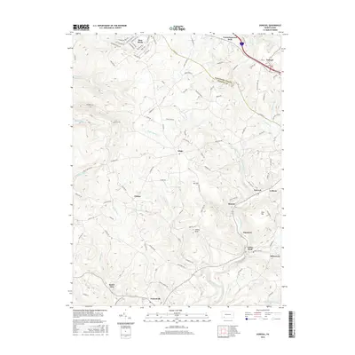
2016 Map of Donegal
USGS Topo · Published 2016About this map
The Laurel Highlands border of Westmoreland and Fayette counties is defined by a landscape of high ridges and narrow creek valleys. This 2016 survey shows the transition from the resort and residential areas of Bear Rocks and Cummingswood Park in the north down to the long-standing communities of Melcroft and Indian Head. The local geography is shaped by the drainage of Indian Creek, Champion Creek, and Jacobs Creek, with Lake Donegal and the Green Lick Reservoir serving as primary water features. Genealogists and local historians will find several small settlements and family-named landmarks, such as Brown Cemetery and Jockey Knob, interspersed among a dense network of mountain roads like Kreinbrook Hill Road and Chestnut Ridge Road. The map documents the enduring rural character of towns like Normalville and Sagamore, where the rugged terrain has historically dictated the path of human settlement and transport.
Find a feature on this map
108 named features on this map. Tap any name to fly to it.
Don’t see what you’re looking for? This feature index may not catch every label — zoom into the map to look around manually.
Map Details
Editions of this 2016 Donegal Map
This is the sole edition of this map. No revisions or reprints were ever made.
Other maps of this area

1900 · Uniontown
USGS Topo · 1:62,500

1902 · Connellsville
USGS Topo · 1:62,500

1922 · Confluence
USGS Topo · 1:62,500

1922 · Donegal
USGS Topo · 1:62,500

1931 · Connellsville
USGS Topo · 1:62,500

1931 · Uniontown
USGS Topo · 1:62,500

1931 · Confluence
USGS Topo · 1:62,500

1933 · Confluence
USGS Topo · 1:62,500

1935 · Donegal
USGS Topo · 1:62,500

1936 · Connellsville
USGS Topo · 1:62,500
Featured Places
- Donegal, PA
- Donegal Township, PA
- Mount Pleasant Township, PA
- Springfield Township, PA
- Bear Rocks, Bullskin Township