
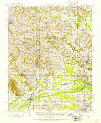
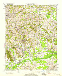
1920 Map of Dongola
USGS Topo · Published 1953About this map
The Cache River winds through Southern Illinois, anchoring a landscape defined by its wetlands and early 20th-century rail infrastructure. Surveyed just after the Great War, the terrain reveals a dense network of country schools and rural congregations such as St Johns Church and Mt Pleasant Church. The Illinois Central and the Chicago and Eastern Illinois railroads serve as the primary conduits for local commerce, connecting established towns like Dongola and Anna to the broader regional economy.
Find a feature on this map
79 named features on this map. Tap any name to fly to it.
Don’t see what you’re looking for? This feature index may not catch every label — zoom into the map to look around manually.
Map Details
Editions of this 1920 Dongola Map
3 editions found
Other maps of this area

1918 · Vienna
USGS Topo · 1:62,500

1919 · Vienna
USGS Topo · 1:62,500

1920 · Jonesboro
USGS Topo · 1:62,500

1922 · Carbondale
USGS Topo · 1:62,500

1923 · Dongola
USGS Topo · 1:62,500

1923 · Jonesboro
USGS Topo · 1:62,500

1924 · Alto Pass
USGS Topo · 1:62,500

1925 · Marion
USGS Topo · 1:62,500

1928 · La Center
USGS Topo · 1:62,500

1931 · Cairo
USGS Topo · 1:62,500