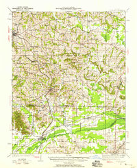
1920 Map of Dongola
USGS Topo · Published 1958About this map
State Hospital and the railroad hub of Anna anchor the northwestern portion of this Southern Illinois landscape, surveyed during the first decades of the twentieth century. The terrain is defined by the winding course of the Cache River and its numerous tributaries, including Cypress Creek and Mill Creek, which shaped the placement of local settlements and farmsteads. The regional economy is clearly marked by the competing rail lines of the Illinois Central and the Chicago and Eastern Illinois, which converge at junctions like Ullin and Joppa Junction.
Find a feature on this map
66 named features on this map. Tap any name to fly to it.
Don’t see what you’re looking for? This feature index may not catch every label — zoom into the map to look around manually.
Map Details
Editions of this 1920 Dongola Map
3 editions found
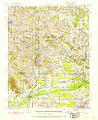
Other maps of this area

1918 · Vienna
USGS Topo · 1:62,500

1919 · Vienna
USGS Topo · 1:62,500

1920 · Jonesboro
USGS Topo · 1:62,500

1920 · Dongola
USGS Topo · 1:62,500

1922 · Carbondale
USGS Topo · 1:62,500

1923 · Dongola
USGS Topo · 1:62,500

1923 · Jonesboro
USGS Topo · 1:62,500

1924 · Alto Pass
USGS Topo · 1:62,500

1925 · Marion
USGS Topo · 1:62,500

1928 · La Center
USGS Topo · 1:62,500