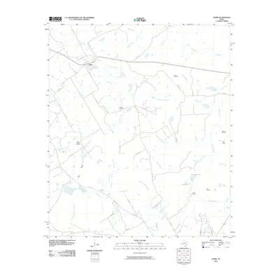
2010 Map of Donie
USGS Topo · Published 2010About this map
The community of Donie anchors the upper portion of this East Texas survey, established at the junction of FM 80 and Co RD 754. The landscape is defined by an intricate network of drainage basins, including the headwaters of Buffalo Creek, Lambs Creek, and Alligator Creek. This 2010 edition illustrates a rural environment where local history is preserved in numerous family and community burial grounds such as Old Zion Cemetery, Post Oak Cemetery, and Wilsons Chapel Cemetery.
Find a feature on this map
54 named features on this map. Tap any name to fly to it.
Don’t see what you’re looking for? This feature index may not catch every label — zoom into the map to look around manually.
Map Details
Editions of this 2010 Donie Map
This is the sole edition of this map. No revisions or reprints were ever made.
Other maps of this area

1919 · Fairfield
USGS Topo · 1:62,500

1920 · Mexia
USGS Topo · 1:62,500

1954 · Waco
USGS Topo · 1:250,000

1955 · Waco
USGS Topo · 1:250,000

1956 · Jewett
USGS Topo · 1:62,500

1965 · Jewett
USGS Topo · 1:24,000
1965 · Robbins
USGS Topo · 1:24,000

1965 · Dew
USGS Topo · 1:24,000
1965 · Lanely
USGS Topo · 1:24,000
1965 · Buffalo
USGS Topo · 1:24,000