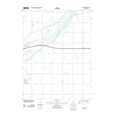
2011 Map of Doniphan
USGS Topo · Published 2011About this map
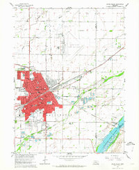
Doniphan and the surrounding Hall County agricultural landscape are defined by the braided channels of the Platte River system as it appeared in 2011. The town is anchored by the Doniphan Post Office and sits just south of the Cedarview Cemetery. The hydrology of the region is complex, featuring the Middle Channel Platte River and the South Channel Platte River, which carve out significant landforms such as Indian Island and Mormon Island. These riverine features, alongside smaller waterways like Beaver Creek and Lincoln Creek, historically dictated the patterns of settlement and the grid of rural roads like S Blaine St and S Stuhr Rd. To the northeast, Riverside Lake sits near the river's edge, highlighting the interaction between the water's shifting course and the established township borders.
Find a feature on this map
44 named features on this map. Tap any name to fly to it.
Don’t see what you’re looking for? This feature index may not catch every label — zoom into the map to look around manually.
Map Details
Editions of this 2011 Doniphan Map
This is the sole edition of this map. No revisions or reprints were ever made.
Other maps of this area

1892 · Grand Island
USGS Topo · 1:62,500

1895 · Grand Island
USGS Topo · 1:62,500

1898 · Grand Island
USGS Topo · 1:125,000

1955 · Grand Island
USGS Topo · 1:250,000

1957 · Grand Island
USGS Topo · 1:250,000

1958 · Grand Island
USGS Topo · 1:250,000
1962 · Abbott
USGS Topo · 1:24,000
1962 · Phillips
USGS Topo · 1:24,000
1962 · Doniphan
USGS Topo · 1:24,000
1962 · Grand Island
USGS Topo · 1:24,000