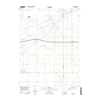
2014 Map of Doniphan
USGS Topo · Published 2014About this map
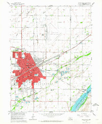
The Middle Channel Platte River and South Channel Platte River dominate this landscape, creating a complex network of braided waterways and islands south of Grand Island. This 2014 survey captures the rural character of the area where Mormon Island and Indian Island sit between the shifting channels. To the south, the settlement of Doniphan serves as a local hub near the Cedarview Cem. The map illustrates a strict section-line road grid, including Giltner Rd W and Lowry Rd E, which navigates the hydrological features of Beaver Cr and Lincoln Cr. This interplay between the vast Platte River system and the established agricultural grid highlights the region's reliance on the river's path while maintaining a structured land use pattern typical of central Nebraska.
Find a feature on this map
48 named features on this map. Tap any name to fly to it.
Don’t see what you’re looking for? This feature index may not catch every label — zoom into the map to look around manually.
Map Details
Editions of this 2014 Doniphan Map
This is the sole edition of this map. No revisions or reprints were ever made.
Other maps of this area

1892 · Grand Island
USGS Topo · 1:62,500

1895 · Grand Island
USGS Topo · 1:62,500

1898 · Grand Island
USGS Topo · 1:125,000

1955 · Grand Island
USGS Topo · 1:250,000

1957 · Grand Island
USGS Topo · 1:250,000

1958 · Grand Island
USGS Topo · 1:250,000
1962 · Abbott
USGS Topo · 1:24,000
1962 · Phillips
USGS Topo · 1:24,000
1962 · Doniphan
USGS Topo · 1:24,000
1962 · Grand Island
USGS Topo · 1:24,000