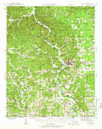
1939 Map of Doniphan
USGS Topo · Published 1966About this map
The Current River carves a winding path through the center of this landscape, serving as a primary corridor for both industry and recreation in the late 1930s. The regional hub of Doniphan is clearly established along its banks, connected by the Missouri Pacific railroad. The surrounding countryside reveals a dense network of rural infrastructure, defined by an exceptional number of small school districts such as Bellview East Sch, Dizmang Sch, and Barkadaro Sch.
Find a feature on this map
108 named features on this map. Tap any name to fly to it.
Don’t see what you’re looking for? This feature index may not catch every label — zoom into the map to look around manually.
Map Details
Editions of this 1939 Doniphan Map
3 editions found
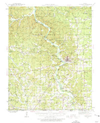
Other maps of this area

1934 · Williamsville
USGS Topo · 1:48,000

1935 · Acorn
USGS Topo · 1:62,500

1935 · Knobel
USGS Topo · 1:62,500

1935 · Reyno
USGS Topo · 1:62,500

1939 · Doniphan
USGS Topo · 1:62,500

1940 · Williamsville
USGS Topo · 1:62,500

1940 · Naylor
USGS Topo · 1:62,500

1941 · Gatewood
USGS Topo · 1:62,500

1941 · Knobel
USGS Topo · 1:62,500

1944 · Naylor
USGS Topo · 1:62,500