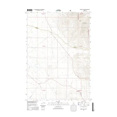
2013 Map of Donkey Hills NW
USGS Topo · Published 2013About this map
Challis National Forest land meets the high country of the Lemhi Range in this high-desert mountain survey along the border of Lemhi and Custer counties. The Pahsimeroi River valley provides a focal point for settlement, most notably at Goldburg, where the Goldburg Rd connects this remote community to the surrounding wilderness. The landscape is defined by the drainage systems of several significant creeks, including Big Creek, Goldburg Creek, and Doublespring Creek, which carve through the high elevations. Access to these areas is mapped via early 21st-century tracks such as Doublespring Pass Rd and McCoy Ln, tracing the routes used by ranchers and foresters. The intersection of public forest lands and private agricultural use in the river valley illustrates the traditional land-use patterns of rural Idaho.
Find a feature on this map
59 named features on this map. Tap any name to fly to it.
Don’t see what you’re looking for? This feature index may not catch every label — zoom into the map to look around manually.
Map Details
Editions of this 2013 Donkey Hills NW Map
This is the sole edition of this map. No revisions or reprints were ever made.
Other maps of this area

1935 · Borah Peak
USGS Topo · 1:125,000

1938 · Borah Peak
USGS Topo · 1:125,000

1955 · Dubois
USGS Topo · 1:250,000

1956 · Patterson
USGS Topo · 1:62,500

1956 · Donkey Hills
USGS Topo · 1:62,500

1956 · Doublespring
USGS Topo · 1:62,500

1956 · May
USGS Topo · 1:62,500

1958 · Dubois
USGS Topo · 1:250,000

1980 · Leadore
USGS Topo · 1:100,000
1989 · Mahogany Hill
USGS Topo · 1:24,000