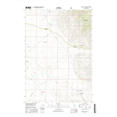
2017 Map of Donkey Hills NW
USGS Topo · Published 2017About this map
The Pahsimeroi Valley serves as a stark natural boundary where high mountain slopes meet a broad alluvial basin along the Lemhi and Custer County line. This landscape is defined by the drainage systems of the Pahsimeroi River and its tributaries, including Doublespring Cr and Goldburg Cr, which flow out from the foothills of the Lemhi Range. The settlement of Goldburg anchors the southeastern corner of the quadrangle, connected to the wider region by a network of ranch and forest roads. A significant portion of the northeastern terrain is managed within the Challis National Forest, where the topography rises sharply. The local road system, including the Pahsimeroi Rd and Farm To Market Rd, traces the historic routes of agricultural and livestock transit through this high-desert mountain environment.
Find a feature on this map
27 named features on this map. Tap any name to fly to it.
Don’t see what you’re looking for? This feature index may not catch every label — zoom into the map to look around manually.
Map Details
Editions of this 2017 Donkey Hills NW Map
This is the sole edition of this map. No revisions or reprints were ever made.
Other maps of this area

1935 · Borah Peak
USGS Topo · 1:125,000

1938 · Borah Peak
USGS Topo · 1:125,000

1955 · Dubois
USGS Topo · 1:250,000

1956 · Patterson
USGS Topo · 1:62,500

1956 · Donkey Hills
USGS Topo · 1:62,500

1956 · Doublespring
USGS Topo · 1:62,500

1956 · May
USGS Topo · 1:62,500

1958 · Dubois
USGS Topo · 1:250,000

1980 · Leadore
USGS Topo · 1:100,000
1989 · Mahogany Hill
USGS Topo · 1:24,000