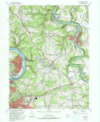
1993 Map of Donora
USGS Topo · Published 1993About this map
The Youghiogheny River and Monongahela River dominate this Pennsylvania landscape, carving deep valleys that define the industrial and residential corridors of Donora and West Newton. This 1993 edition highlights the area's transition, showing the density of older riverfront settlements alongside mid-century expansions like Rostraver Airport. While the map reflects modern infrastructure, it preserves significant genealogical markers, including family-named sites like Weaver and Waddell Cem and the Concord Pioneer Sch (Historical Landmark).
Find a feature on this map
94 named features on this map. Tap any name to fly to it.
Don’t see what you’re looking for? This feature index may not catch every label — zoom into the map to look around manually.
Map Details
Editions of this 1993 Donora Map
2 editions found
Other maps of this area

1902 · Brownsville
USGS Topo · 1:62,500

1902 · Connellsville
USGS Topo · 1:62,500

1904 · Mc Keesport
USGS Topo · 1:62,500

1904 · Greensburg
USGS Topo · 1:62,500

1906 · Brownsville
USGS Topo · 1:62,500

1906 · Greensburg
USGS Topo · 1:62,500

1907 · Pittsburg
USGS Topo · 1:62,500

1931 · Brownsville
USGS Topo · 1:62,500

1931 · Connellsville
USGS Topo · 1:62,500

1933 · Brownsville
USGS Topo · 1:62,500