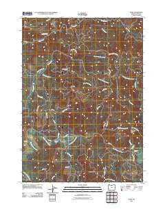
2011 Map of Dora
USGS Topo · Published 2011About this map
The small settlement of Dora serves as the focal point for this survey of the Oregon Coast Range foothills, situated where the East Fork Coquille River meets a complex network of timber and access roads. The landscape is defined by its dramatic relief, including Cherry Creek Ridge and the prominent Sheeps Head summit to the south. Historically significant landmarks such as the McKinley Cemetery and the localized geography of Brewster Canyon and Brewster Valley provide valuable context for family historians and local researchers. The area's dedication to recreation and conservation is evident in the presence of the Middle Creek Recreation Area, the 4H Camp, and the Big Tree Natural Area. Numerous watercourses, including Cherry Creek, Middle Creek, and Elk Creek, drain these high ridges, reflecting the drainage patterns of the Coos County interior.
Find a feature on this map
45 named features on this map. Tap any name to fly to it.
Don’t see what you’re looking for? This feature index may not catch every label — zoom into the map to look around manually.
Map Details
Editions of this 2011 Dora Map
This is the sole edition of this map. No revisions or reprints were ever made.
Other maps of this area

1896 · Coos Bay
USGS Topo · 1:125,000

1898 · Coos Bay
USGS Topo · 1:125,000

1900 · Coos Bay
USGS Topo · 1:125,000

1928 · Sitkum
USGS Topo · 1:125,000

1942 · Coquille
USGS Topo · 1:62,500

1942 · Coos Bay
USGS Topo · 1:62,500

1945 · Coquille
USGS Topo · 1:62,500

1945 · Coos Bay
USGS Topo · 1:62,500

1954 · Coos Bay
USGS Topo · 1:250,000

1955 · Ivers Peak
USGS Topo · 1:62,500