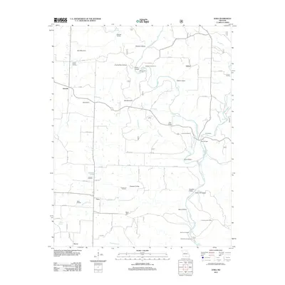
2012 Map of Dora
USGS Topo · Published 2012About this map
The North Fork River carves through this Ozark landscape, defining a region of steep hollows and high points like Bear Mountain and Red Mountain. The map centers on the small communities of Dora, Hebron, and Richville, revealing a rural network of county roads and family-named landmarks. Genealogists will find numerous small burial grounds, including the Pleasant Mound Cemetery, Cudworth Cemetery, and Sweeton Cemetery, which speak to the long-standing settlement of the area.
Find a feature on this map
43 named features on this map. Tap any name to fly to it.
Don’t see what you’re looking for? This feature index may not catch every label — zoom into the map to look around manually.
Map Details
Editions of this 2012 Dora Map
This is the sole edition of this map. No revisions or reprints were ever made.
Other maps of this area

1934 · Gainesville
USGS Topo · 1:48,000

1937 · Buckhart
USGS Topo · 1:48,000

1939 · Topaz
USGS Topo · 1:62,500

1940 · Gainesville
USGS Topo · 1:62,500

1941 · Topaz
USGS Topo · 1:62,500

1943 · Buckhart
USGS Topo · 1:62,500

1944 · Cureall
USGS Topo · 1:62,500

1945 · Harrison
USGS Topo · 1:250,000

1945 · Buckhart
USGS Topo · 1:62,500

1946 · Cureall
USGS Topo · 1:62,500