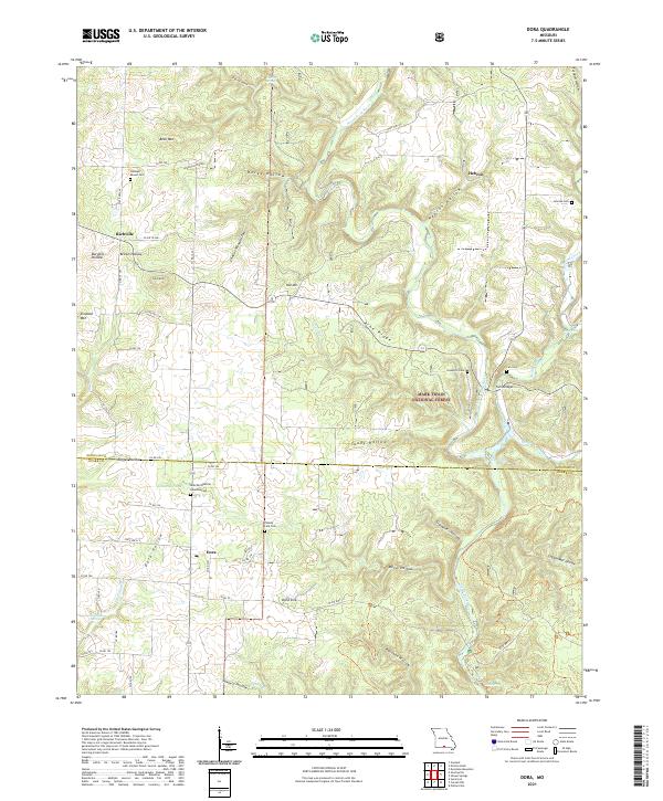
2021 Map of Dora
USGS Topo · Published 2021About this map
Dora serves as a central hub in this section of the Ozarks, positioned where State Hwy CC and Highway 181 intersect. The landscape is heavily defined by its karst topography and deep drainage systems, most notably the North Fork River and the numerous springs that feed it, including Big Spring, Blue Spring, and Hicks Spring. To the north, the terrain rises toward Bear Mtn and Simpson Mtn, while the southern reaches are marked by the unique Dora Sink. Local genealogy is well-preserved through a network of rural burial sites such as Pleasant Mound Cem near Richville, Innman Cem outside Hebron, and the County Line Cem situated along the border of Douglas and Ozark Counties. Much of the eastern portion is protected within the Mark Twain National Forest, maintaining the wooded character of Pine Ridge and Toady Hollow.
Find a feature on this map
68 named features on this map. Tap any name to fly to it.
Don’t see what you’re looking for? This feature index may not catch every label — zoom into the map to look around manually.
Map Details
Editions of this 2021 Dora Map
This is the sole edition of this map. No revisions or reprints were ever made.
Other maps of this area

1934 · Gainesville
USGS Topo · 1:48,000

1937 · Buckhart
USGS Topo · 1:48,000

1939 · Topaz
USGS Topo · 1:62,500

1940 · Gainesville
USGS Topo · 1:62,500

1941 · Topaz
USGS Topo · 1:62,500

1943 · Buckhart
USGS Topo · 1:62,500

1944 · Cureall
USGS Topo · 1:62,500

1945 · Harrison
USGS Topo · 1:250,000

1945 · Buckhart
USGS Topo · 1:62,500

1946 · Cureall
USGS Topo · 1:62,500