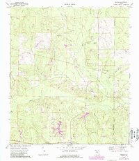
1973 Map of Dorcas
USGS Topo · Published 1987About this map
Shoal River meanders across this Panhandle landscape, defining the local geography as it flows through the southern half of the quadrangle. During the 1970s and 1980s, the area maintained a rural character centered on crossroads communities and small settlements. The C S X railroad line runs east-west through Deerland, providing a critical transport corridor alongside local industrial sites like the Claypit and Sandpit.
Find a feature on this map
49 named features on this map. Tap any name to fly to it.
Don’t see what you’re looking for? This feature index may not catch every label — zoom into the map to look around manually.
Map Details
Editions of this 1973 Dorcas Map
2 editions found
Other maps of this area

1934 · Holt
USGS Topo · 1:48,000

1934 · Niceville
USGS Topo · 1:48,000

1936 · Niceville
USGS Topo · 1:62,500

1937 · Holt
USGS Topo · 1:62,500

1949 · Crestview
USGS Topo · 1:62,500

1949 · Laurel Hill
USGS Topo · 1:62,500

1950 · Laurel Hill
USGS Topo · 1:62,500

1951 · Crestview
USGS Topo · 1:62,500

1956 · Niceville
USGS Topo · 1:62,500

1956 · Holt
USGS Topo · 1:62,500