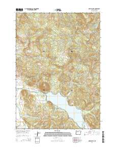
2014 Map of Dorena Lake
USGS Topo · Published 2014About this map
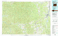
Dorena Lake dominates this central Oregon landscape, where the waters of the Row River are impounded within a basin of prominent peaks. Significant elevations like Cerro Gordo, Bald Mtn, and Cougar Mtn ring the water, reflecting the transition from valley floors to the foothills of the Cascades. For genealogists and local historians, the Doolittle Cem remains a notable landmark on the northern slopes above the lake, while the placement of Currin Bridge and Stewart Bridge over the northern reaches of the Row River indicates established crossing points for early timber and agricultural routes. The network of roads, including Witcher Extension Rd and Garoutte Rd, illustrates the access into these drainages, connecting the recreational waters of Baker Bay to the surrounding hills and tributary creeks such as Mosby Creek and Gettings Cr.
Find a feature on this map
49 named features on this map. Tap any name to fly to it.
Don’t see what you’re looking for? This feature index may not catch every label — zoom into the map to look around manually.
Map Details
Editions of this 2014 Dorena Lake Map
This is the sole edition of this map. No revisions or reprints were ever made.
Other maps of this area
1921 · Cottage Grove
USGS Topo · 1:62,500
1935 · Lowell
USGS Topo · 1:96,000
1942 · Lowell
USGS Topo · 1:125,000
1954 · Anlauf
USGS Topo · 1:62,500
1955 · Culp Creek
USGS Topo · 1:62,500
1955 · Lowell
USGS Topo · 1:62,500
1957 · Cottage Grove
USGS Topo · 1:62,500

1958 · Roseburg
USGS Topo · 1:250,000

1959 · Roseburg
USGS Topo · 1:250,000
1979 · Cottage Grove
USGS Topo · 1:100,000