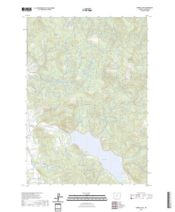
2024 Map of Dorena Lake
USGS Topo · Published 2024About this map
Dorena Lake serves as the central focal point of this part of Lane County, with Baker Bay and several named inlets defining the shoreline. The surrounding landscape is characterized by a network of creeks and prominent peaks, including Cerro Gordo, Bald Mtn, and Cougar Mtn. Local history is anchored by sites like the Doolittle Cem and the recreational Row River Trail-Asphalt Trl, which follows the path of the Row River through the valley. Rural development is concentrated along these watercourses, with several family-named roads such as Garoutte Rd and Otis Chapman Rd hinting at the area's ancestral landholdings and logging history. The map also traces various smaller tributaries like Mosby Creek and Gettings Creek as they descend from the higher elevations of Prune Hill and Bear Mtn.
Find a feature on this map
56 named features on this map. Tap any name to fly to it.
Don’t see what you’re looking for? This feature index may not catch every label — zoom into the map to look around manually.
Map Details
Editions of this 2024 Dorena Lake Map
This is the sole edition of this map. No revisions or reprints were ever made.
Other maps of this area

1921 · Cottage Grove
USGS Topo · 1:62,500

1935 · Lowell
USGS Topo · 1:96,000

1942 · Lowell
USGS Topo · 1:125,000

1954 · Anlauf
USGS Topo · 1:62,500

1955 · Culp Creek
USGS Topo · 1:62,500

1955 · Lowell
USGS Topo · 1:62,500
1957 · Cottage Grove
USGS Topo · 1:62,500

1958 · Roseburg
USGS Topo · 1:250,000

1959 · Roseburg
USGS Topo · 1:250,000

1979 · Cottage Grove
USGS Topo · 1:100,000