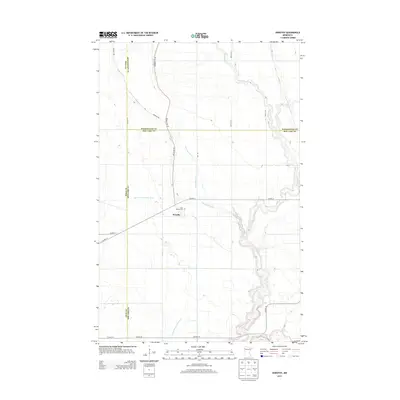
2013 Map of Dorothy
USGS Topo · Published 2013About this map
Dorothy serves as the focal point for this rural portion of Red Lake County, situated at the intersection of several county routes and local roads. The landscape is defined by the winding course of the Black River and its tributary, the Little Black River, which meander through a terrain also shaped by agricultural engineering, notably Judicial Ditch Number Sixty and Lateral Ditch Number Four. For local historians and genealogists, the Saint Dorothy Cem near the town center provides a point of historical continuity. A significant cultural trace is the Pembina Trl, which cuts diagonally across the northern townships, marking the historic route used by traders and settlers between the Red River Valley and the interior. This network of old trails and modern drainage systems illustrates the transition from primitive wilderness paths to a highly organized agrarian environment.
Find a feature on this map
20 named features on this map. Tap any name to fly to it.
Don’t see what you’re looking for? This feature index may not catch every label — zoom into the map to look around manually.
Map Details
Editions of this 2013 Dorothy Map
This is the sole edition of this map. No revisions or reprints were ever made.
Other maps of this area

1918 · Angus
USGS Topo · 1:62,500

1918 · Red Lake Falls
USGS Topo · 1:62,500

1918 · Viking
USGS Topo · 1:62,500

1952 · Red Lake Falls
USGS Topo · 1:62,500

1952 · Grand Forks
USGS Topo · 1:250,000

1952 · Thief River Falls
USGS Topo · 1:250,000

1953 · Crookston
USGS Topo · 1:62,500

1956 · Thief River Falls
USGS Topo · 1:250,000

1956 · Grand Forks
USGS Topo · 1:250,000

1957 · Thief River Falls
USGS Topo · 1:250,000