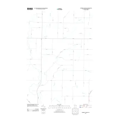
2013 Map of Dorrity Creek
USGS Topo · Published 2013About this map
The Hay River defines the western landscape of this Barron County terrain, winding through a rural grid of agriculture and timber. This 2013 survey illustrates the drainage patterns of the Arland area, where numerous small waterways like Dorrity Cr and Quaderer Cr intersect a strictly numbered road system. The presence of Sweeny Pond and various seasonal wetlands suggests a low-lying, water-rich environment characteristic of this portion of northern Wisconsin. While traditional settlement names are absent on this specific sheet, the dense network of local routes such as 11th Ave and 97th St provides a detailed framework for understanding the modern division of historic farmsteads. Smaller tributaries including Lower Pine Cr and Spring Cr carve through the southern sections, marking the subtle elevation changes that dictate the local watershed.
Find a feature on this map
46 named features on this map. Tap any name to fly to it.
Don’t see what you’re looking for? This feature index may not catch every label — zoom into the map to look around manually.
Map Details
Editions of this 2013 Dorrity Creek Map
This is the sole edition of this map. No revisions or reprints were ever made.
Other maps of this area

1948 · Downing
USGS Topo · 1:62,500

1949 · Ridgeland
USGS Topo · 1:62,500

1950 · Downing
USGS Topo · 1:62,500

1950 · Turtle Lake
USGS Topo · 1:62,500

1951 · Ridgeland
USGS Topo · 1:62,500

1951 · Barron
USGS Topo · 1:62,500

1952 · Turtle Lake
USGS Topo · 1:62,500

1953 · Rice Lake
USGS Topo · 1:250,000

1953 · Stillwater
USGS Topo · 1:250,000

1955 · Stillwater
USGS Topo · 1:250,000