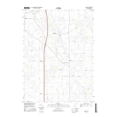
2016 Map of Dorset
USGS Topo · Published 2016About this map
Mill Creek and its various tributaries, including Askue Run and Peters Cr, define the rural landscape of eastern Ashtabula County. This survey captures a mix of small settlements and agricultural infrastructure, centered on the community of Dorset. To the west, the eastern edge of Jefferson is visible, while the small hubs of Rowenton and Sentinel mark local crossroads. The map highlights key historical landmarks such as Williams Cem, South Denmark Cem, and Dorset Cem, which serve as vital points of interest for genealogists tracking local families. Local transportation and industry are represented by the South Denmark Road Bridge and Allen Airport, illustrating the balance between traditional township roads and modern utility in this corner of Ohio.
Find a feature on this map
44 named features on this map. Tap any name to fly to it.
Don’t see what you’re looking for? This feature index may not catch every label — zoom into the map to look around manually.
Map Details
Editions of this 2016 Dorset Map
This is the sole edition of this map. No revisions or reprints were ever made.
Other maps of this area

1905 · Andover
USGS Topo · 1:48,000

1905 · Ashtabula
USGS Topo · 1:62,500

1905 · Jefferson
USGS Topo · 1:62,500

1906 · Conneaut
USGS Topo · 1:62,500

1907 · Andover
USGS Topo · 1:62,500

1907 · Jefferson
USGS Topo · 1:62,500

1950 · Cleveland
USGS Topo · 1:250,000

1956 · Cleveland
USGS Topo · 1:250,000

1959 · Dorset
USGS Topo · 1:24,000
1959 · Andover
USGS Topo · 1:24,000