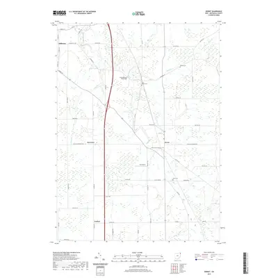
2019 Map of Dorset
USGS Topo · Published 2019About this map
Jefferson and the smaller settlements of Dorset, Rowenton, and Sentinel define this agricultural landscape in eastern Ohio. The terrain is deeply tied to its water systems, including the southward-flowing Mill Creek and the meandering Askue Run. A network of township and county roads, such as Footville-Richmond Rd and S Denmark Rd, connect local homesteads and family cemeteries. Genealogy researchers can find markers like Williams Cem, South Denmark Cem, and Dorset Cem scattered throughout the rural acreage. The presence of Allen Airport and the South Denmark Road Bridge reflects the modern infrastructure supporting this long-established farming community. Large sections of wetlands are visible along the creek bottoms, particularly around Peters Cr, illustrating the natural drainage patterns that have shaped land use in Ashtabula County for generations.
Find a feature on this map
46 named features on this map. Tap any name to fly to it.
Don’t see what you’re looking for? This feature index may not catch every label — zoom into the map to look around manually.
Map Details
Editions of this 2019 Dorset Map
This is the sole edition of this map. No revisions or reprints were ever made.
Other maps of this area

1905 · Andover
USGS Topo · 1:48,000

1905 · Ashtabula
USGS Topo · 1:62,500

1905 · Jefferson
USGS Topo · 1:62,500

1906 · Conneaut
USGS Topo · 1:62,500

1907 · Andover
USGS Topo · 1:62,500

1907 · Jefferson
USGS Topo · 1:62,500

1950 · Cleveland
USGS Topo · 1:250,000

1956 · Cleveland
USGS Topo · 1:250,000

1959 · Dorset
USGS Topo · 1:24,000
1959 · Andover
USGS Topo · 1:24,000