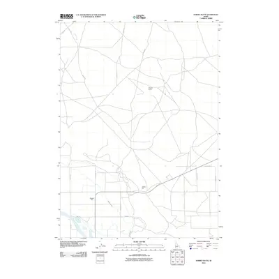
2010 Map of Dorsey Butte
USGS Topo · Published 2010About this map
Dorsey Butte rises above the high desert landscape of Ada County, overlooking a network of agricultural infrastructure and seasonal watercourses. The 2010 geography is defined by the critical management of water across the Chattin Flat, where the Middle Line Canal and Low Line Canal facilitate irrigation for the surrounding plains. The Snake River cuts across the southwestern corner of the sheet, providing the primary hydrological anchor for the region, while natural drainages like Jack Creek and Corder Creek thread through the township grids. A complex grid of roads, including Weaver Rd and S Hayland Rd, serves the farmsteads and rural properties concentrated near Chattin Hill. This survey captures the rural character of southwestern Idaho at a time when traditional agricultural land use remained the dominant feature of the landscape.
Find a feature on this map
20 named features on this map. Tap any name to fly to it.
Don’t see what you’re looking for? This feature index may not catch every label — zoom into the map to look around manually.
Map Details
Editions of this 2010 Dorsey Butte Map
This is the sole edition of this map. No revisions or reprints were ever made.
Other maps of this area

1892 · Mountain Home
USGS Topo · 1:125,000

1892 · Bisuka
USGS Topo · 1:125,000

1893 · Mountain Home
USGS Topo · 1:125,000

1894 · Bisuka
USGS Topo · 1:125,000

1946 · Mouth of Bruneau
USGS Topo · 1:24,000

1947 · Grand View
USGS Topo · 1:62,500

1947 · Bruneau
USGS Topo · 1:62,500

1947 · Grand View
USGS Topo · 1:24,000

1947 · Jackass Butte
USGS Topo · 1:24,000

1947 · Vinson Wash
USGS Topo · 1:24,000