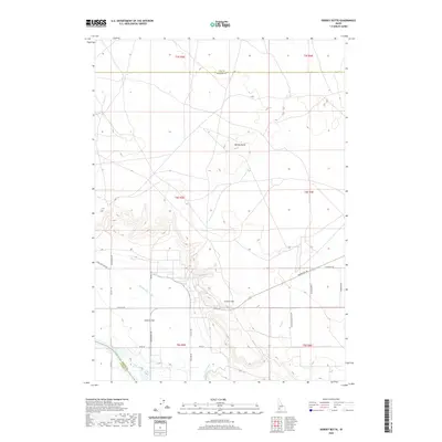
2020 Map of Dorsey Butte
USGS Topo · Published 2020About this map
Dorsey Butte and the surrounding high desert terrain define this landscape at the intersection of Ada, Elmore, and Owyhee counties. The southern portion of the quadrangle is shaped by the presence of the Snake River, where the elevation drops significantly from the open plateaus. Human engineering is evident in the network of irrigation systems, such as the Middle Line Canal and Low Line Canal, which divert water to support agriculture in the area of Chattin Flat. These canals represent the critical infrastructure necessary for settlement in this arid environment, contrasting with natural drainages like Corder Cr and Jack Cr. The map details a grid of rural roads, including Grandview Rd and River Rd, which provide access to the remote ranches and land parcels near Chattin Hill.
Find a feature on this map
30 named features on this map. Tap any name to fly to it.
Don’t see what you’re looking for? This feature index may not catch every label — zoom into the map to look around manually.
Map Details
Editions of this 2020 Dorsey Butte Map
This is the sole edition of this map. No revisions or reprints were ever made.
Other maps of this area

1892 · Mountain Home
USGS Topo · 1:125,000

1892 · Bisuka
USGS Topo · 1:125,000

1893 · Mountain Home
USGS Topo · 1:125,000

1894 · Bisuka
USGS Topo · 1:125,000

1946 · Mouth of Bruneau
USGS Topo · 1:24,000

1947 · Grand View
USGS Topo · 1:62,500

1947 · Bruneau
USGS Topo · 1:62,500

1947 · Grand View
USGS Topo · 1:24,000

1947 · Jackass Butte
USGS Topo · 1:24,000

1947 · Vinson Wash
USGS Topo · 1:24,000