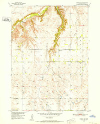
1950 Map of Dorsey NW
USGS Topo · Published 1952About this map
Redbird Creek carves a deep, meandering course through the northwestern corner of this Nebraska landscape, defining a terrain of sharp elevation changes before the land levels into the agricultural plains of Scott and Steel townships. Surveyed as part of the Missouri River Basin development program, the map captures the rural infrastructure of the early 1950s, where one-room schoolhouses like School No 63 and School No 32 served as local anchors for farming families.
Find a feature on this map
14 named features on this map. Tap any name to fly to it.
Don’t see what you’re looking for? This feature index may not catch every label — zoom into the map to look around manually.
Map Details
Editions of this 1950 Dorsey NW Map
3 editions found
Other maps of this area

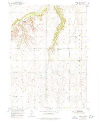
1950 · Dorsey NW
USGS Topo · 1:24,000

1950 · Lynch
USGS Topo · 1:24,000

1950 · Monowi
USGS Topo · 1:24,000

1951 · Bristow
USGS Topo · 1:24,000

1952 · Monowi
USGS Topo · 1:24,000

1952 · Dorsey
USGS Topo · 1:24,000

1954 · Dorsey SW
USGS Topo · 1:24,000

1954 · Meek NE
USGS Topo · 1:24,000

1954 · Opportunity
USGS Topo · 1:24,000

1954 · Star
USGS Topo · 1:24,000