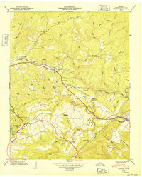
1949 Map of Dorton
USGS Topo · Published 1967About this map
Cumberland Homesteads defines the lower half of this survey, showcasing a unique New Deal-era planned community. The landscape is marked by public works and social infrastructure, including the Homestead Sch, Homestead Cem, and the waters of Byrd Lake within Cumberland State Park. Transportation serves as a central theme, with the Tennessee Central Railroad and the Broadway of America cutting through the center of the quadrangle. North of the rail line, the terrain transitions into the ridges of Chestnut Oak Ridge and Hyder Ridge. Small rural nodes like Dorton and Crab Orchard provide evidence of early mid-century Appalachian settlement, while the winding course of Daddys Creek and its many branches like Muddy Br illustrate the complex drainage patterns of the Cumberland Plateau.
Find a feature on this map
91 named features on this map. Tap any name to fly to it.
Don’t see what you’re looking for? This feature index may not catch every label — zoom into the map to look around manually.
Map Details
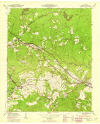
Editions of this 1949 Dorton Map
2 editions found
Other maps of this area

1887 · Kingston
USGS Topo · 1:125,000

1891 · Kingston
USGS Topo · 1:125,000

1892 · Pikeville
USGS Topo · 1:125,000

1893 · Kingston
USGS Topo · 1:125,000

1895 · Wartburg
USGS Topo · 1:125,000

1895 · Pikeville
USGS Topo · 1:125,000

1896 · Wartburg
USGS Topo · 1:125,000

1897 · Standingstone
USGS Topo · 1:125,000

1898 · Standingstone
USGS Topo · 1:125,000

1912 · Crossville
USGS Topo · 1:62,500