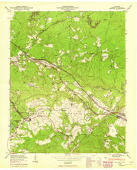
1949 Map of Dorton
USGS Topo · Published 1949About this map
Dorton and Crab Orchard anchor this Cumberland Plateau landscape during a period of transition as the Tennessee Central Railroad was being developed through the region. The map highlights the intersection of public land and rural settlement, notably within Cumberland State Park and the surrounding homestead areas. Local community life is centered around institutions like Baker Chapel, Homestead Sch, and Chestnut Hill School.
Find a feature on this map
63 named features on this map. Tap any name to fly to it.
Don’t see what you’re looking for? This feature index may not catch every label — zoom into the map to look around manually.
Map Details
Editions of this 1949 Dorton Map
2 editions found
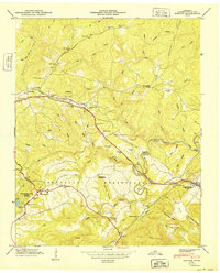
Other maps of this area

1887 · Kingston
USGS Topo · 1:125,000

1891 · Kingston
USGS Topo · 1:125,000

1892 · Pikeville
USGS Topo · 1:125,000

1893 · Kingston
USGS Topo · 1:125,000

1895 · Wartburg
USGS Topo · 1:125,000

1895 · Pikeville
USGS Topo · 1:125,000

1896 · Wartburg
USGS Topo · 1:125,000

1897 · Standingstone
USGS Topo · 1:125,000

1898 · Standingstone
USGS Topo · 1:125,000

1912 · Crossville
USGS Topo · 1:62,500