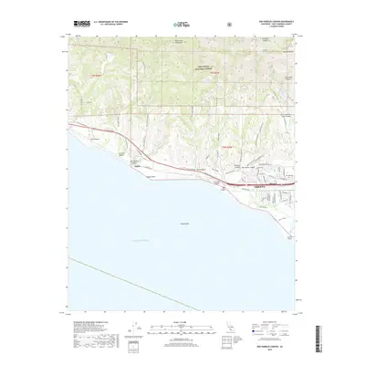
2018 Map of Dos Pueblos Canyon
USGS Topo · Published 2018About this map
Goleta and the coastal settlements of Naples and Ellwood occupy this stretch of the Santa Barbara County coastline, where the Santa Ynez Mountains meet the Pacific Ocean. The landscape is defined by a series of deep drainages, including Dos Pueblos Canyon, Tecolote Canyon, and Glen Annie Canyon, which descend from the Los Padres National Forest toward the sea. The historic El Camino Real and Hollister Ave serve as the primary east-west arteries, connecting residential developments near Ellwood Mesa to the more open ranch lands and canyons to the west. A notable piece of water infrastructure, the Tecolote Tunnel, is marked near the northern edge of the sheet, while offshore features like Naples Reef and Coal Oil Point highlight the transition from terrestrial to maritime environments. This survey documents the intersection of suburban expansion and protected natural areas just prior to the turn of the decade.
Find a feature on this map
66 named features on this map. Tap any name to fly to it.
Don’t see what you’re looking for? This feature index may not catch every label — zoom into the map to look around manually.
Map Details
Editions of this 2018 Dos Pueblos Canyon Map
This is the sole edition of this map. No revisions or reprints were ever made.
Other maps of this area

1902 · Santa Ynez
USGS Topo · 1:125,000

1905 · Santa Ynez
USGS Topo · 1:125,000

1905 · Lompoc
USGS Topo · 1:125,000

1941 · San Rafael Mtn.
USGS Topo · 1:62,500

1942 · Lompoc
USGS Topo · 1:125,000

1942 · Gaviota
USGS Topo · 1:62,500

1942 · Goleta
USGS Topo · 1:62,500

1942 · San Rafael Mtn.
USGS Topo · 1:62,500

1942 · Los Olivos
USGS Topo · 1:62,500

1943 · San Rafael Mtn.
USGS Topo · 1:62,500