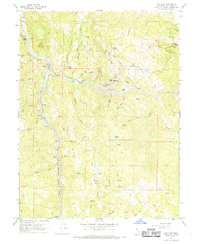
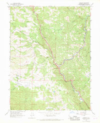
1967 Map of Dos Rios
USGS Topo · Published 1969About this map
Dos Rios serves as the focal point of this 1960s landscape, positioned at the confluence where the Middle Fork Eel River joins the main branch of the Eel River. The steep, canyon-defined geography is navigated by the Northwestern Pacific railroad, which follows the winding riverbank southward past Tatu. This transportation corridor was vital for the remote settlements and camps of the Mendocino wilderness, connecting isolated outposts like Deer Lodge and Hunters Camp to the broader region.
Find a feature on this map
44 named features on this map. Tap any name to fly to it.
Don’t see what you’re looking for? This feature index may not catch every label — zoom into the map to look around manually.
Map Details
Editions of this 1967 Dos Rios Map
4 editions found
Other maps of this area

1920 · Covelo
USGS Topo · 1:62,500

1926 · Covelo
USGS Topo · 1:62,500

1929 · Eden Valley
USGS Topo · 1:62,500

1951 · Laytonville
USGS Topo · 1:62,500

1952 · Spyrock
USGS Topo · 1:62,500

1952 · Eden Valley
USGS Topo · 1:62,500

1952 · Covelo
USGS Topo · 1:62,500

1957 · Ukiah
USGS Topo · 1:250,000

1960 · Ukiah
USGS Topo · 1:250,000
1966 · Longvale
USGS Topo · 1:24,000