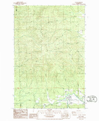
1986 Map of Doty
USGS Topo · Published 1986About this map
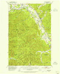
The Chehalis River valley serves as the primary corridor for settlement and industry in this 1980s Lewis County landscape. The communities of Doty and Dryad are established along the riverbanks, where an Old R. R. Grade indicates the historical importance of rail transport for moving timber from the surrounding uplands. These uplands are dominated by the Doty Hills and prominent peaks like Bucks Knob, dissected by an intricate drainage system including North Fork Lincoln Creek and South Fork Lincoln Creek. Evidence of local resource extraction is found in several Borrow Pits scattered near the ridge lines. For those tracing local history, the Sylvan Cem stands near the river, while smaller settlements like Murnen represent the dispersed nature of habitation along the creeks that feed into the Chehalis, such as Elk Creek and Bunker Creek.
Find a feature on this map
30 named features on this map. Tap any name to fly to it.
Don’t see what you’re looking for? This feature index may not catch every label — zoom into the map to look around manually.
Map Details
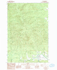
Editions of this 1986 Doty Map
2 editions found
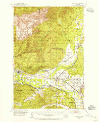
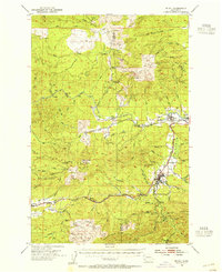
Other maps of this area

1941 · Walville
USGS Topo · 1:62,500

1941 · Meskill
USGS Topo · 1:62,500

1941 · Gate
USGS Topo · 1:62,500

1941 · Ford
USGS Topo · 1:62,500

1953 · Hoquiam
USGS Topo · 1:250,000
1953 · Rochester
USGS Topo · 1:62,500
1953 · Pe Ell
USGS Topo · 1:62,500
1953 · Malone
USGS Topo · 1:62,500
1953 · Adna
USGS Topo · 1:62,500

1957 · Hoquiam
USGS Topo · 1:250,000