
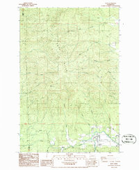
1986 Map of Doty
USGS Topo · Published 1994About this map
The Chehalis River valley defines the southeastern corner of this map, where the small community of Doty and the neighboring settlement of Dryad are located. This area shows a transition from the river bottomlands to the significant elevations of the Doty Hills, which dominate the central and northern portions of the quadrangle. A network of drainages including Lincoln Creek, Wildcat Creek, and Fall River carve through the landscape, indicating a geography heavily influenced by these watercourses.
Find a feature on this map
27 named features on this map. Tap any name to fly to it.
Don’t see what you’re looking for? This feature index may not catch every label — zoom into the map to look around manually.
Map Details
Editions of this 1986 Doty Map
2 editions found
Other maps of this area

1941 · Walville
USGS Topo · 1:62,500

1941 · Meskill
USGS Topo · 1:62,500

1941 · Gate
USGS Topo · 1:62,500

1941 · Ford
USGS Topo · 1:62,500

1953 · Hoquiam
USGS Topo · 1:250,000

1953 · Rochester
USGS Topo · 1:62,500

1953 · Pe Ell
USGS Topo · 1:62,500

1953 · Malone
USGS Topo · 1:62,500

1953 · Adna
USGS Topo · 1:62,500

1957 · Hoquiam
USGS Topo · 1:250,000