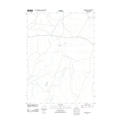
2012 Map of Double Butte
USGS Topo · Published 2012About this map
Double Butte rises above the high plains of Fremont County, anchoring a landscape defined by an intricate network of seasonal drainage and water management. This early twenty-first-century survey illustrates the vital importance of water storage in the Wyoming basin, as seen in the distribution of North Logan Reservoir, Sucker Reservoir, and the Homestead Flat Reservoir. These catchments, along with the Double Butte Reservoir and the more southerly Chimney Rock Reservoir, suggest a reliance on collected runoff for ranching and local land use. The natural hydrology is shaped by Conant Cr and Horseshoe Cr., which carve through the terrain near landmarks like Logan Gulch. The sparse road network and scattered reservoirs indicate a vast, working landscape where topographic features and water access dictate the movement of people and livestock.
Find a feature on this map
9 named features on this map. Tap any name to fly to it.
Don’t see what you’re looking for? This feature index may not catch every label — zoom into the map to look around manually.
Map Details
Editions of this 2012 Double Butte Map
This is the sole edition of this map. No revisions or reprints were ever made.
Other maps of this area

1951 · Fuller Reservoir
USGS Topo · 1:24,000

1952 · Squaw Butte
USGS Topo · 1:24,000

1952 · Rongis Reservoir SE
USGS Topo · 1:24,000

1952 · Double Butte
USGS Topo · 1:24,000

1952 · Haybarn Hill
USGS Topo · 1:24,000

1952 · Rongis Reservoir
USGS Topo · 1:24,000

1952 · Butte Well
USGS Topo · 1:24,000

1953 · Blue Gulch
USGS Topo · 1:24,000

1953 · Campbell Ridge
USGS Topo · 1:24,000

1955 · Thermopolis
USGS Topo · 1:250,000