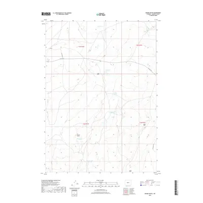
2018 Map of Double Butte
USGS Topo · Published 2018About this map
Double Butte stands as the central landmark in this high-plains landscape within Fremont County. The terrain is defined by a series of water management features, including North Logan Reservoir, Sucker Reservoir, and the Double Butte Reservoir, which likely serve local livestock or irrigation needs in an otherwise arid environment. Evidence of human infrastructure is found in the network of unpaved transit ways like Gas Hills Rd and the Jeep Pasture Trl, indicating the area's use for ranching or resource extraction. Physical geographic markers such as Signor Ridge and Logan Gulch provide a clear sense of the vertical relief that channels intermittent drainages like Horseshoe Cr and Conant Cr. These labels reflect a functional, working landscape where water and topography dictate the movement of people and livestock.
Find a feature on this map
19 named features on this map. Tap any name to fly to it.
Don’t see what you’re looking for? This feature index may not catch every label — zoom into the map to look around manually.
Map Details
Editions of this 2018 Double Butte Map
This is the sole edition of this map. No revisions or reprints were ever made.
Other maps of this area

1951 · Fuller Reservoir
USGS Topo · 1:24,000

1952 · Squaw Butte
USGS Topo · 1:24,000

1952 · Rongis Reservoir SE
USGS Topo · 1:24,000

1952 · Double Butte
USGS Topo · 1:24,000

1952 · Haybarn Hill
USGS Topo · 1:24,000

1952 · Rongis Reservoir
USGS Topo · 1:24,000

1952 · Butte Well
USGS Topo · 1:24,000

1953 · Blue Gulch
USGS Topo · 1:24,000

1953 · Campbell Ridge
USGS Topo · 1:24,000

1955 · Thermopolis
USGS Topo · 1:250,000