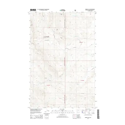
2014 Map of Double Falls
USGS Topo · Published 2014About this map
Lewis & Clark National Forest encompasses the entirety of this landscape, where the high ridges of the Rocky Mountain Front meet the headwaters of the Missouri River basin. The terrain is defined by dramatic elevation changes, notably at Fairview Mtn and along Lime Ridge, which overlooks the descent into Lime Gulch. A network of forest service and ranching access roads, including Beaver Willow Rd and Augusta Ranger Sta Rd, provides passage through these canyons. The water system is particularly intricate, featuring the eponymous Double Falls and the confluence of several branches of Willow Creek, Ford Creek, and Smith Creek. These drainages have historically shaped the accessibility of the region, creating natural corridors like The Steps that have served generations of travelers and forest managers in this section of Lewis and Clark County.
Find a feature on this map
34 named features on this map. Tap any name to fly to it.
Don’t see what you’re looking for? This feature index may not catch every label — zoom into the map to look around manually.
Map Details
Editions of this 2014 Double Falls Map
This is the sole edition of this map. No revisions or reprints were ever made.
Other maps of this area

1903 · Saypo
USGS Topo · 1:125,000

1903 · Coopers Lake
USGS Topo · 1:125,000

1955 · Choteau
USGS Topo · 1:250,000

1957 · Choteau
USGS Topo · 1:250,000

1958 · Choteau
USGS Topo · 1:250,000

1958 · Barr Creek
USGS Topo · 1:24,000

1958 · Sawtooth Ridge
USGS Topo · 1:24,000

1958 · Patricks Basin
USGS Topo · 1:24,000

1962 · Choteau
USGS Topo · 1:250,000
1970 · Scapegoat Mountain
USGS Topo · 1:24,000