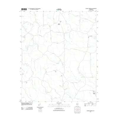
2012 Map of Double Springs
USGS Topo · Published 2012About this map
Double Springs and Lebanon anchor this 2012 study of the Mississippi backcountry north of Sturgis. The landscape is defined by a dense network of tributaries including Trim Cane Cr, Big Cr, and Cypress Cr, which carve through a mosaic of woodlots and rural clearings. For genealogists, the map is an exceptional resource, meticulously locating several family and community burial grounds such as Double Springs Cem, McMinn Cem, and Mount Olive Cem. The settlement at Pleasant Ridge in the southeast corner marks a significant crossroads near Pleasant Ridge Cem. Modern infrastructure like Sturgis Maben Rd and Sturgis W Point Rd follows older travel corridors, connecting these scattered rural clusters and providing a clear view of the area's late 20th-century development patterns.
Find a feature on this map
73 named features on this map. Tap any name to fly to it.
Don’t see what you’re looking for? This feature index may not catch every label — zoom into the map to look around manually.
Map Details
Editions of this 2012 Double Springs Map
This is the sole edition of this map. No revisions or reprints were ever made.
Other maps of this area

1953 · West Point
USGS Topo · 1:250,000

1958 · West Point
USGS Topo · 1:250,000

1959 · Pheba
USGS Topo · 1:62,500

1963 · West Point
USGS Topo · 1:250,000

1965 · Longview
USGS Topo · 1:24,000

1965 · Bradley
USGS Topo · 1:24,000

1972 · Maben
USGS Topo · 1:24,000

1972 · Sapa
USGS Topo · 1:24,000

1972 · Double Springs
USGS Topo · 1:24,000

1972 · Sturgis
USGS Topo · 1:24,000