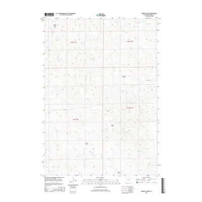
2015 Map of Double Tanks
USGS Topo · Published 2015About this map
Double Tanks Spring and a series of water management features define this high plains landscape in Campbell County. The drainage network is dominated by the Middle Prong Dead Horse Cr and Dead Horse Cr to the north, while Beaver Cr and N Beaver Cr cut through the southern reaches. This era of land use is characterized by numerous small-scale water catchments, including Hart Reservoir, Arno Spring Reservoir, and Charlie Reservoir, which provide essential resources for ranching in this arid environment. The map details a complex topography of erosional features such as Blackbird Draw, Johnnie Draw, and Pinette Draw. Man-made infrastructure is sparse, primarily limited to the passage of Napier Rd, which navigates the township boundaries of T48N and T47N.
Find a feature on this map
19 named features on this map. Tap any name to fly to it.
Don’t see what you’re looking for? This feature index may not catch every label — zoom into the map to look around manually.
Map Details
Editions of this 2015 Double Tanks Map
This is the sole edition of this map. No revisions or reprints were ever made.
Other maps of this area

1953 · Fats Draw
USGS Topo · 1:24,000

1954 · Gillette
USGS Topo · 1:250,000

1955 · Newcastle
USGS Topo · 1:250,000

1955 · Gillette
USGS Topo · 1:250,000

1958 · Gillette
USGS Topo · 1:250,000

1958 · Newcastle
USGS Topo · 1:250,000

1959 · Savageton
USGS Topo · 1:62,500

1959 · North Star School
USGS Topo · 1:62,500

1962 · Gillette
USGS Topo · 1:250,000
1971 · Double Tanks
USGS Topo · 1:24,000