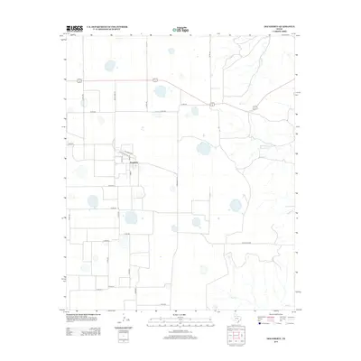
2012 Map of Dougherty
USGS Topo · Published 2012About this map
Dougherty stands as a focal point of this West Texas landscape, its small grid of streets including Hansford Ave, Hale St, and Lamb St contrasting with the expansive agricultural sections surrounding it. The terrain is marked by numerous small depressions and seasonal watercourses characteristic of the Llano Estacado. Drainage features like Mott Creek in the northeast and Wolf Creek in the south define the subtle elevation changes. The transportation network is built upon a rigid section line system, with Ranch Road 28 providing a primary north-south artery through the territory. This 2012 survey illustrates a classic High Plains settlement pattern where a compact residential and commercial center serves a wide-reaching rural community of farms and ranches, interconnected by a dense web of county roads such as Co Rd-260 and Co Rd-314.
Find a feature on this map
30 named features on this map. Tap any name to fly to it.
Don’t see what you’re looking for? This feature index may not catch every label — zoom into the map to look around manually.
Map Details
Editions of this 2012 Dougherty Map
This is the sole edition of this map. No revisions or reprints were ever made.
Other maps of this area

1954 · Lubbock
USGS Topo · 1:250,000

1954 · Plainview
USGS Topo · 1:250,000

1958 · Plainview
USGS Topo · 1:250,000

1965 · Wake
USGS Topo · 1:24,000

1965 · Boothe
USGS Topo · 1:24,000

1966 · Lockney 4 SW
USGS Topo · 1:24,000

1966 · Mount Blanco
USGS Topo · 1:24,000

1967 · Dick Moore Canyon
USGS Topo · 1:24,000

1967 · Whiteflat
USGS Topo · 1:24,000

1968 · Mac Bain
USGS Topo · 1:24,000