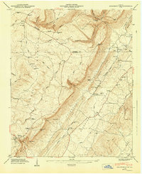
1947 Map of Dougherty Gap
USGS Topo · Published 1947About this map
Lookout Mountain and Pigeon Mountain dominate the topography of Northwest Georgia in this mid-century survey, creating a dramatic corridor through Shinbone Ridge and into the Broomtown Valley. The landscape is defined by its gaps and gulfs, such as Dougherty Gap, Neal Gap, and Dougherty Gulf, which dictated the movement of early settlers and the placement of the Tennessee Alabama and Georgia rail line.
Find a feature on this map
57 named features on this map. Tap any name to fly to it.
Don’t see what you’re looking for? This feature index may not catch every label — zoom into the map to look around manually.
Map Details
Editions of this 1947 Dougherty Gap Map
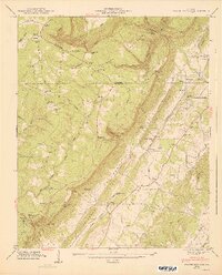
2 editions found
Other maps of this area

1886 · Ringgold
USGS Topo · 1:125,000

1886 · Rome
USGS Topo · 1:125,000

1886 · Stevenson
USGS Topo · 1:125,000

1892 · Ringgold
USGS Topo · 1:125,000

1892 · Stevenson
USGS Topo · 1:125,000

1893 · Fort Payne
USGS Topo · 1:125,000

1895 · Stevenson
USGS Topo · 1:125,000

1898 · Rome
USGS Topo · 1:125,000

1898 · Fort Payne
USGS Topo · 1:125,000

1899 · Rome
USGS Topo · 1:125,000