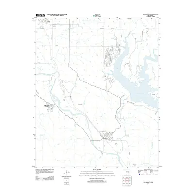
2012 Map of Dougherty
USGS Topo · Published 2012About this map
The Washita River carves a winding path through this corner of Oklahoma, anchoring a landscape where the southern reaches of Lake of the Arbuckles and the steep terrain of Burning Mtn converge. This survey captures a mix of religious retreat sites and industrial activity, notably the Falls Creek Assembly near Price Falls and the Vines Oil Field to the east. The township of Dougherty serves as a primary hub, while the surrounding hills contain family landmarks like James Cem and Price Cem. Regional land management is evident through the extensive Chickasaw Wildlife Mgt area, which borders the reservoir. The map documents the intricate road network serving residential pockets along the lake's fingers, including Shangrila and various tribal-named thoroughfares such as Chickasaw Trl and Arapaho Dr.
Find a feature on this map
87 named features on this map. Tap any name to fly to it.
Don’t see what you’re looking for? This feature index may not catch every label — zoom into the map to look around manually.
Map Details
Editions of this 2012 Dougherty Map
This is the sole edition of this map. No revisions or reprints were ever made.
Other maps of this area

1898 · Pauls Valley
USGS Topo · 1:125,000

1901 · Stonewall
USGS Topo · 1:125,000

1901 · Tishomingo
USGS Topo · 1:125,000

1901 · Ardmore
USGS Topo · 1:125,000

1902 · Pauls Valley
USGS Topo · 1:125,000

1918 · Ardmore
USGS Topo · 1:125,000

1957 · Ardmore
USGS Topo · 1:250,000

1963 · Ardmore
USGS Topo · 1:250,000

1963 · Sulphur South
USGS Topo · 1:24,000

1963 · Nebo
USGS Topo · 1:24,000