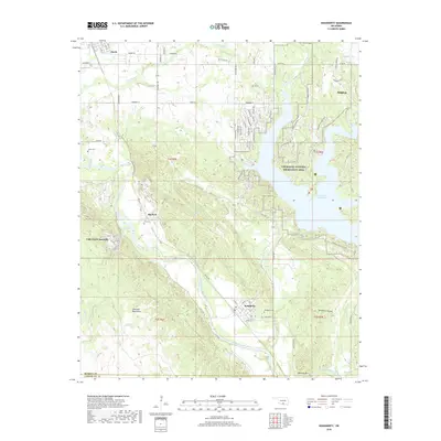
2018 Map of Dougherty
USGS Topo · Published 2018About this map
Dougherty sits at the confluence of the Washita River and several creek drainages, marking a point where the river winds through the southern foothills of the Arbuckle Mountains. This landscape is defined by the significant footprint of the Chickasaw National Recreation Area and the waters of the Lake of the Arbuckles. The terrain transitions from the elevations of Burning Mtn and Sycamore Hollow to the river valley, where the Bnsf rail line follows the water's path through the town of Dougherty.
Find a feature on this map
81 named features on this map. Tap any name to fly to it.
Don’t see what you’re looking for? This feature index may not catch every label — zoom into the map to look around manually.
Map Details
Editions of this 2018 Dougherty Map
This is the sole edition of this map. No revisions or reprints were ever made.
Other maps of this area

1898 · Pauls Valley
USGS Topo · 1:125,000

1901 · Stonewall
USGS Topo · 1:125,000

1901 · Tishomingo
USGS Topo · 1:125,000

1901 · Ardmore
USGS Topo · 1:125,000

1902 · Pauls Valley
USGS Topo · 1:125,000

1918 · Ardmore
USGS Topo · 1:125,000

1957 · Ardmore
USGS Topo · 1:250,000

1963 · Ardmore
USGS Topo · 1:250,000

1963 · Sulphur South
USGS Topo · 1:24,000

1963 · Nebo
USGS Topo · 1:24,000