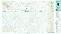
1994 Map of Douglas
USGS Topo · Published 1994About this map
Bisbee and its neighboring mining towns of Warren, Lowell, and Don Luis anchor the western portion of this mid-1990s international border survey. This era shows the heavy industrial and transportation infrastructure of the Copper Queen region, with the Southern Pacific railroad lines connecting the mineral wealth of the Mule Mountains to the processing and shipping centers in Douglas. The map documents the intricate network of mines including the Uncle Sam Mine and Saginaw Mine, illustrating how the geology of Escabrosa Ridge shaped the local economy.
Find a feature on this map
65 named features on this map. Tap any name to fly to it.
Don’t see what you’re looking for? This feature index may not catch every label — zoom into the map to look around manually.
Map Details
Editions of this 1994 Douglas Map
2 editions found
Other maps of this area

1902 · Bisbee
USGS Topo · 1:62,500

1910 · Bisbee
USGS Topo · 1:62,500

1914 · Hereford
USGS Topo · 1:125,000

1914 · Douglas
USGS Topo · 1:62,500

1915 · Benson
USGS Topo · 1:125,000

1916 · Pearce
USGS Topo · 1:125,000

1916 · Douglas
USGS Topo · 1:125,000

1917 · Chiricahua
USGS Topo · 1:125,000

1918 · Cienega Springs
USGS Topo · 1:62,500

1918 · Animas Peak
USGS Topo · 1:62,500