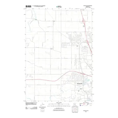
2010 Map of Douglas
USGS Topo · Published 2010About this map
Rochester anchors the southern half of this landscape, showing a suburban expansion defined by modern residential developments and recreational spaces like the Northern Hills Golf Course and Meadows Lake Golf Course. The map captures the meeting of the city's growing edge with the rural character of Olmsted County, where established landmarks such as Camp Edith Mayo and the Mount Hope Cemetery sit just beyond the suburban reach. To the north, the small settlements of Genoa and Douglas maintain a more traditional rural layout, connected by a network of county roads and highway corridors.
Find a feature on this map
34 named features on this map. Tap any name to fly to it.
Don’t see what you’re looking for? This feature index may not catch every label — zoom into the map to look around manually.
Map Details
Editions of this 2010 Douglas Map
This is the sole edition of this map. No revisions or reprints were ever made.
Other maps of this area

1935 · Rochester
USGS Topo · 1:48,000

1939 · Rochester
USGS Topo · 1:62,500

1953 · Saint Paul
USGS Topo · 1:250,000

1954 · Mason City
USGS Topo · 1:250,000

1955 · Stewartville
USGS Topo · 1:62,500

1955 · High Forest
USGS Topo · 1:62,500

1957 · Mason City
USGS Topo · 1:250,000

1958 · Mason City
USGS Topo · 1:250,000

1959 · Saint Paul
USGS Topo · 1:250,000

1965 · Oronoco
USGS Topo · 1:24,000