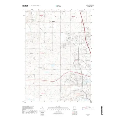
2019 Map of Douglas
USGS Topo · Published 2019About this map
Rochester expands its northwestern reach in this 2019 survey, showing the transition from dense residential and commercial development to the agricultural landscapes of Olmsted County. The map features the International Business Machine facility as a major landmark of local industry, situated near the intersection of modern transit corridors. To the west, the smaller settlements of Douglas and Genoa retain their distinct identities, while Byron occupies the southwestern corner of the quadrangle.
Find a feature on this map
86 named features on this map. Tap any name to fly to it.
Don’t see what you’re looking for? This feature index may not catch every label — zoom into the map to look around manually.
Map Details
Editions of this 2019 Douglas Map
This is the sole edition of this map. No revisions or reprints were ever made.
Other maps of this area

1935 · Rochester
USGS Topo · 1:48,000

1939 · Rochester
USGS Topo · 1:62,500

1953 · Saint Paul
USGS Topo · 1:250,000

1954 · Mason City
USGS Topo · 1:250,000

1955 · Stewartville
USGS Topo · 1:62,500

1955 · High Forest
USGS Topo · 1:62,500

1957 · Mason City
USGS Topo · 1:250,000

1958 · Mason City
USGS Topo · 1:250,000

1959 · Saint Paul
USGS Topo · 1:250,000

1965 · Oronoco
USGS Topo · 1:24,000