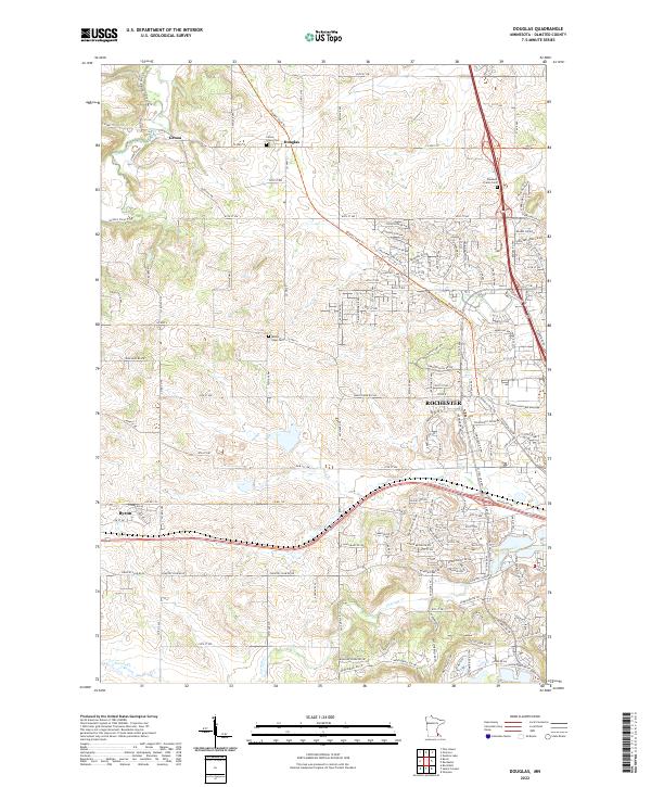
2022 Map of Douglas
USGS Topo · Published 2022About this map
The S Br Middle Fork Zumbro R and Cascade Cr carve through the Olmsted County landscape, defining the rural and suburban character of this region northwest of Rochester. The map highlights a significant transition from the small settlements of Genoa and Douglas to the industrial and commercial presence of International Bus Machine. Transport corridors like the Douglas State Trl and Co HWY 14 facilitate movement across the terrain, linking the growing community of Byron to the larger urban center. Genealogists can locate several historic burial sites, including Center Grove Cem, Pleasant Prairie Cem, and Mount Hope Cem. This survey illustrates the modern road network, from local routes like Town Hall Rd NW to the expanding subdivisions and infrastructure supporting the northern reaches of Rochester.
Find a feature on this map
39 named features on this map. Tap any name to fly to it.
Don’t see what you’re looking for? This feature index may not catch every label — zoom into the map to look around manually.
Map Details
Editions of this 2022 Douglas Map
This is the sole edition of this map. No revisions or reprints were ever made.
Other maps of this area

1935 · Rochester
USGS Topo · 1:48,000

1939 · Rochester
USGS Topo · 1:62,500

1953 · Saint Paul
USGS Topo · 1:250,000

1954 · Mason City
USGS Topo · 1:250,000

1955 · Stewartville
USGS Topo · 1:62,500

1955 · High Forest
USGS Topo · 1:62,500

1957 · Mason City
USGS Topo · 1:250,000

1958 · Mason City
USGS Topo · 1:250,000

1959 · Saint Paul
USGS Topo · 1:250,000

1965 · Oronoco
USGS Topo · 1:24,000