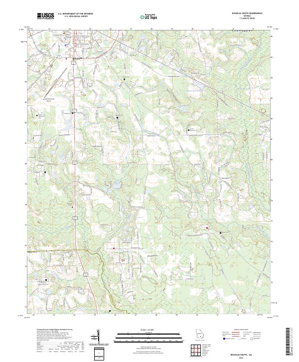
2024 Map of Douglas South
USGS Topo · Published 2024About this map
Douglas serves as the focal point for this southern Georgia region, where the urban grid of the city meets the expansive wetlands and river systems of the coastal plain. The campus of South Georgia State College and the Douglas Municipal Airport mark the northern transition into the city, while the southern landscape is defined by the winding course of the Satilla River. The geography is notable for its numerous family and community burial grounds, including Wayfare Cem, Morman Cem, and the New Harmony Grove Missionary Baptist Church Cem, which reflect the deep-rooted settlement patterns of the area.
Find a feature on this map
149 named features on this map. Tap any name to fly to it.
Don’t see what you’re looking for? This feature index may not catch every label — zoom into the map to look around manually.
Map Details
Editions of this 2024 Douglas South Map
This is the sole edition of this map. No revisions or reprints were ever made.
Other maps of this area

1953 · Waycross
USGS Topo · 1:250,000

1958 · Waycross
USGS Topo · 1:250,000

1971 · Douglas North
USGS Topo · 1:24,000

1971 · Douglas South
USGS Topo · 1:24,000

1971 · Nicholls
USGS Topo · 1:24,000

1971 · Wilsonville
USGS Topo · 1:24,000

1971 · Axson
USGS Topo · 1:24,000

1971 · Pearson
USGS Topo · 1:24,000

1972 · Kirkland
USGS Topo · 1:24,000

1972 · Mora
USGS Topo · 1:24,000